The Course to Hobart has distinct stages.
Rolex Sydney Hobart Yacht Race 2021: Where is the EAC?
Topics: Sydney to Hobart, sailing, East Australian Current, tides, optimised route, Tidemap, grib, yacht race, yacht racing
Are you entering the 2021 Vineyard Race?
The complex strong tidal currents at the eastern end of Long Island Sound can be challenging for even the most experienced race navigators.
Key questions need to be considered. Will you depart Long Island Sound via The Race, Plum Gut, or The Sluiceway? What are your tactics for the return back into Long Island Sound on the way home? How you negotiate these complex and strong tidal currents could be the difference between a good race and a Great Race.
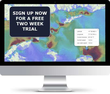
Fortunately, Tidetech has accurate high-resolution tidal current forecast models for the entire course available in GRIB format. This allows you to make the best navigation decisions giving you more time to simply sail fast and gain an advantage over your closest competitors.
Topics: currents, Expedition, sailing, yacht, racing, optimised route, high resolution model, grib, yacht race, Vineyard Race
The prestigious Rolex Fastnet Race is just a few weeks away, and competitors who have the most accurate data on hand will be able to make the best possible decisions for the fastest route.
The Fastnet is genuinely a navigators' race, as it challenges competitors to negotiate some very tricky tidal situations - such as whether to head offshore for pressure or tuck inshore to avoid the worst of an adverse tide. This year's race is exciting because it's finishing in France for the first time, and the last section involves negotiating the notorious Alderney Race, with currents of up to 9 kts.
Topics: sailing, tides, English Channel, Tidemap, grib, yacht race, yacht racing, Fastnet
We are very pleased to release a new model of Chesapeake Bay in time for the Annapolis to Newport Race! Sourced from NOAA the model covers the entire bay in incredible detail, showing for the first time the complexity of the currents everywhere in the Bay from Annapolis to Cape Charles, including the Potomac River.
Topics: currents, Expedition, sailing, yacht, racing, optimised route, high resolution model, grib, yacht race, Vineyard Race
At approximately 110 miles long, with a large population base on its' shores and abundant natural beauty, Long Island Sound is one of the busiest waterways in the United States. As you can see from the image below most vessels navigating the Sound are recreational, although there are also numerous passenger vessels and fishing traffic.
Topics: long island sound
The creation of ocean current maps depend on the measurement of sea level, which is the base level for measuring elevation and depth on Earth.
The English Channel is home to some of the strongest and most complex tides in Europe. It is one of the most heavily trafficked locations in the world, with many different types of vessels transiting east and west through the Channel or crossing between ports in southern England and Europe.
Topics: English Channel
Long Term Weather Forecasting Doesn’t Have to Be a Guess
No matter how advanced technology becomes, weather forecasting will always carry a degree of uncertainty. Nature is unpredictable, but by combining powerful technology with data, we can produce reasonably reliable evidence-based forecasts for up to ten days.
Did you know that 90% of coastal seas have no tidal data available?
Traditionally, there has been little tidal information available to the public other than height predictions for major (standard) and minor (secondary) ports; even fewer tidal current predictions are available to Mariners other than a limited number of tidal diamonds and tidal stream atlases. These data have traditionally been published by official sources, such as Hydrographic Offices.
Although useful for indicating conditions at the start and end of a journey, this data on its own doesn't provide the level of detail that mariners need for their chosen waterborne activity. In this article, we cover the traditional methods for tidal measurement and their shortcomings and modern technological advancements that can revolutionise the maritime industry in terms of tidal information.
Topics: tides, tidal model, high resolution model, tide-surge forecast
The Currents in Singapore Strait are Extremely Complex. Here's Why.
At 16km wide, and stretching 105km long between the Strait of Malacca and the Karimata Strait, the Singapore Strait is a crucial gateway between Asia and Europe. Due to the high number of ships transiting the area, the Singapore Strait can become incredibly congested and requires a tight traffic management system to ensure that vessels are coming into port at the right time, every time.
Topics: currents, tides, speed optimisation, route optimisation, high resolution model, Malacca Singapore Straits, ship efficiency


.png?width=800&name=H&D%20_%20Blog%20Hero%20Image%20Template%20(8).png)


